Categories
Shopping cart (0 items € 0)
Advanced search

Middle East & Islamic World / Cartography & Exploration

A magnificent copy of a classic world atlas, hand-coloured and sumptuously bound
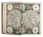
HOMANN, Johann Baptist. Grosser Atlas über die gantze Welt.
Nuremberg, Homann heirs (printed by Johann Heinrich Gottfried Bieling), 1737[-1762]. Folio (34 x 53.5 cm). Letterpress title-page printed in red and black with an engraved map of the northern hemisphere in a polar projection, engraved frontispiece with a globe and a dozen allegorical figures (with a decorated cartouche at the foot giving the title in Latin), engraved portrait of Homann by Johann Wilhelm Winter after Johannes Kenckel, and 98 engraved maps (93 double-page, 1 larger folding in 2 sheets and 4 half-page together on a double-page plate) many with further inset maps and/or views, all with decorated cartouches, often with pictorial decoration or coats of arms; and 3 double-page engraved tables of topographic data. With the engraved title-page and all maps and tables (except for the small north polar projection on the letterpress title-page) coloured by an 18th-century hand, the maps in part or in outline. Gold-tooled red morocco (ca. 1800?) in a neo-classical style, from the workshop of or in the style of Georg Friedrich Krauss (Vienna). [3], [1 blank], 40 pp. plus frontispiece, portrait and 99 double-page plates. Full description
€ 85,000
Order Inquire Terms of sale

Globe made for the rulers of the Southerns Netherlands

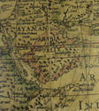
[GLOBE - TERRESTRIAL]. HONDIUS, Jodocus. [Terrestrial globe].
Antwerp, Joan Baptist Vrients [produced by Jodocus Hondius in Amsterdam], Diameter (21 cm). The globe is assembled from 12 engraved gores, mounted over a hollow wooden sphere, the gores hand-coloured in outline, some areas with full colour infill. The zero meridian set at the Azores, the seas decorated with ships and sea monstors, the continents with several figures. The cartouche enclosing a lenghty adress to the reader by Hondius, pointing out the problems of determining longitude. A decorative cartouche set in North America crowned with the coat of arms of the Albert and Isabella Clara of Austria, the text below this cartouche is signed by Hondius and Vrients dedicating this globe to Albert and Isabella. The globe is mounted in a brass meridian circle set within a fixed brass outer circle, secured at the base into 2 brass plates supported by a brass rod rising from an carved wooden mount of ca. 1800. The walnut mount carved, into four faces each with scrolled cartouche divisions, one face with the carved coat of arms of Albert and Isabella. Overall height 50cm. Full description
€ 295,000
Order Inquire Terms of sale

Massive navigational directory for the East

HORSBURGH, James. The India directory, or, directions for sailing to and from the East Indies, China, New Holland, Cape of Good Hope, Brazil, and the interjacent ports ... third edition.
London, printed for the author and sold by Kingsbury, Parbury and Allen, booksellers to the East India Company (back of title-page: printed by Plummer & Brewis), 1826-1827. 2 volumes. 4to. Contemporary half calf, rebacked with the original backstrips laid down. [8], XXVI, 503, [1], 16; [8], 642, [1], [1 blank] pp. Full description
€ 15,000
Order Inquire Terms of sale

Massive navigational directory, with sections on the Arabian Sea, the Red Sea and the Gulf

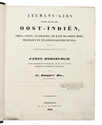
HORSBURGH, James, Gerrit KUIJPER and D. BOES LUTJENS. Zeemans-gids, naar, in en uit Oost-Indiën, China, Japan, Australiën, de Kaap de Goede Hoop, Braziliën en tusschenliggende havens, volgens de vierde Engelsche uitgave van James Horsburgh, ...
Amsterdam, C.F. Stemler, (back of half-title: printed in Haarlem by H. Bakels), 1841. 4to. Contemporary half calf, spine lettered in gold, marbled sides. I-XII, [2], XIII-XXIV, XXVIII, 1376 pp. Full description
€ 3,750
Order Inquire Terms of sale

British military terrain map of the Persian Gulf, published in Calcutta

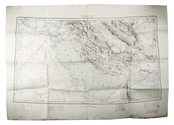
HUNTER, Frederic Fraser (editor); Sir Sidney Gerald BURRARD (director). Southern Asia series - Southern Persia sheet - Persia, Arabia and Turkey in Asia
[Dehradun, Survey of India Office], sold at the Map Record and Issue Office, Calcutta, 1912. 61.5 x 88 cm. Large photozincographed (heliozincographed) folding map on a scale of 1:2,000,000 in black, blue and red, with relief shown by contours, hachures and gradient tints. Folded. Full description
€ 15,000
Order Inquire Terms of sale

Historical narrative of a voyage to India and Persia written by a surgeon of the British Royal Navy

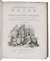
IVES, Edward. Reize naar Oost-Indië en Persië, en de daar omliggende landen. Ondernomen langs een' ongewoonen weg.
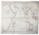
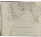
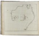
Amsterdam, De Compagnie, 1779. 2 volumes bound as 1. 4to. With 2 engraved title-pages, 2 folding engraved maps, one of India (44 x 51 cm), the other tracking Ives's journey from Basra to Latakia (ca. 42 x 56 cm), and 9 engraved plates (including 1 large folding). Early 20th-century boards. [16], 324; [1], [1 blank], [1], [1 blank], 379, [1] pp. Full description
€ 2,950
Order Inquire Terms of sale

Historical narrative of a voyage to India and Persia written by a surgeon of the British Royal Navy

IVES, Edward. Reize naar Oost-Indië en Persië, en de daar omliggende landen. Ondernomen langs een' ongewoonen weg.
Amsterdam, De Compagnie, 1779. 2 parts in 1 volume. 4to. With 2 engraved title-pages, 2 folding engraved maps, one of India, the other tracking Ives's journey from Basra to Latakia, and 9 engraved plates (including 1 large folding). Contemporary blind-tooled vellum. [16], 324; [1], [1 blank], [1], [1 blank], 379, [1] pp. Full description
€ 3,950
Order Inquire Terms of sale

A teenage sailor’s adventures in Arabia, Mumbai and elsewhere

JAMES, Silas. A narrative of a voyage to Arabia, India; &c; ...; with remarks on the genius and disposition of the natives of Arabia Felix; ...
London, printed by William Glindon, sold by the author, [1797]. 8vo. With a frontispiece portrait of the author engraved by William Newman. Modern dark brown calf, gold-tooled spine. “VI” [= VIII], 7, [1 blank], [1], 10-232 pp. Full description
€ 8,500
Order Inquire Terms of sale

World atlas including one 6-sheet and eleven 4-sheet wall maps

KITCHIN, Thomas and others. Kitchin's general atlas, describing the whole universe.
London, Robert Laurie, James Whittle, 1808. Imperial folio (53 x 39.5 cm). With 28 engraved maps (numbered in 41 parts) assembled from 67 sheets. Most include elaborate cartouches with pictorial decoration. With the maps coloured in outline. Contemporary half calf. 1 leaf plus maps. Full description
€ 18,000
Order Inquire Terms of sale
103 books found / Show all