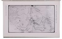
With two large maps of Yemen


WERDECKER, Josef.
A contribution to the geography and cartography of north-west Yemen (based on the results of the exploration by Eduard Glaser, undertaken in the years 1882-1884).
Cairo, lInstitut Français dArchéologie Orientale du Caire, 1939. 8vo. With a portrait of Eduard Glaser, 8 numbered plates and 2 large folding maps. Later half cloth, with the original front wrapper mounted on the front board. [2], 160 pp. Full description
€ 2,800
Cairo, lInstitut Français dArchéologie Orientale du Caire, 1939. 8vo. With a portrait of Eduard Glaser, 8 numbered plates and 2 large folding maps. Later half cloth, with the original front wrapper mounted on the front board. [2], 160 pp. Full description
