Categories
Shopping cart (0 items € 0)
Advanced search

Middle East & Islamic World

Ship's journal from Seychelles and Madagascar,
with numerous maps and earlier illustrated anatomical lecture notes
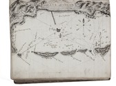
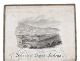
[MANUSCRIPT - SHIP'S JOURNAL]. MORSE, Edward George. A journal of remarks and observations as kept by E. G. M. . ..
[mostly on board the barque Sarah of London], April 1831-14 March 1833 (with additions to 1835). with an engraved view as frontispiece, 15 full-page, 1 nearly full-page and 1 smaller manuscript maps and coastal profiles, plus a small engraved view ("Tomb of Napoleon") mounted on 1 page.
Including: MORSE, Edward George. Lecture Book [notes on anatomical lectures by Joseph Constantine Carpue].
[London], November-December 1828. with a matching pair of engravings of a scull on and facing the title-page, and 27 pencil and/or ink anatomical drawings (including 2 full-page), some also with red. 4to (19.5×16.5 cm). Contemporary sheepskin parchment. [191] ll. Including paste-downs and about 55 blanks. Full description
€ 35,000
Order Inquire Terms of sale

Loans by the UK for major infrastructure development in Jordan

MU'AMMAR, Sayid Ya'coub; B.L. STRACHAN. Exchange of notes concerning an interest-free development loan by the government of the United Kingdom of Great Britain and Northern Ireland to the government of the Hashemite Kingdom of Jordan.
London, Her Majestys Stationery Office, 1970. 4to. With the UK coat-of-arms on title-page. Text in English and Arabic in naskh type. Stapled. 8 pp. Full description
€ 450
Order Inquire Terms of sale

Most extensive edition of a monumental, extensively illustrated description of the world

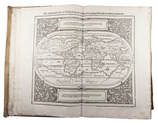
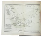
MÜNSTER, Sebastian. Cosmographia, das ist: Beschreibung der gantzen Welt, ...
Basel, heirs of Sebastian Henricpetri, 1628. Folio (38 x 24.5 cm). With engraved title-page, letterpress title-page printed in red and black with woodcut portrait of Münster on the back, 26 numbered double-page woodcut maps on inserted bifolia, 72 double-page woodcut maps, plans and views on integral leaves, and about 1500 woodcut illustrations in the text (including repeats) showing maps, plans, views, plants, animals, monsters, etc. Contemporary vellum. [24], “1752” [=1748] , [12] pp. Full description
€ 48,000
Order Inquire Terms of sale

Handbook to western Arabia, intended for British naval officers only

NAVAL INTELLIGENCE DIVISION, [SCOTT, Hugh, a.o.]. Western Arabia and the Red Sea, B.R. 527 (restricted) geographical handbook series for official use only.
(Colophon: Oxford, University press), Naval Intelligence division, 1946. 8vo. With 357 reproductions of photographs on 90 plates, numerous (folding) maps and illustrations in text and 1 separate folding map. Original publisher's green cloth. XIX, [1 blank], 659, [1 blank] pp. Full description
€ 600
Order Inquire Terms of sale

Rare handbooks of the British naval intelligence division on Arabia, Palestine, and Syria

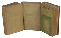
NAVAL INTELLIGENCE DIVISION. Syria. April 1943.
With:
(2) IDEM. Palestine and Transjordan. December 1943.
(3) IDEM. Western Arabia and the Red Sea. June 1943.
Stationery Office, University Press Oxford, 1943-1946.
3 volumes. Many plates, tables and photographs. Each volume including separate fold-out maps, one in colour. Contemporary green cloth with the title in gold on the front boards and the spines. [2], XVI, 485, [1]; [2], XV, [1], 621, [1]; [2], XIX, [1], 659, [1] pp. Full description
€ 1,750
Order Inquire Terms of sale

One of the limited official copies of the British Allied War Effort
of a geographical handbook on Palestine and Jordan

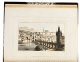
NAVAL INTELLIGENCE DIVISION. Palestine and Transjordan. Geographical handbook series.
(colophon:) Oxford, University Press, December 1943. 2 parts in 1 volume. Large 8vo. With 1 large folding map stored in a pocket on the back board of the communications of Palestine (air fields and landing grounds, railways, roads and sea plane moorings), 2 other folding maps (geological map of Palestine; map of Haifa Harbour), 1 double-page plan of the church of Holy Sepulchre and 58 other figures in the text. Also with 154 half-tone photographs, inserted on separate leaves and all numbered and captioned. Original publisher's green cloth, gilt-lettering on front board and spine. XV, 621, [1 blank] pp. Full description
€ 1,000
Order Inquire Terms of sale

For official use only: Royal Navy wartime handbook on Iraq and the Persian Gulf

NAVAL INTELLIGENCE DIVISION. [MASON, Kenneth, a.o.]. Iraq and the Persian Gulf. September 1944. B.R. 524 (restricted) geographical handbook series for official use only.
[Oxford,] Naval Intelligence division, 1944. 8vo. With numerous diagrams, reproductions of photographs and (folding) maps, including a loose map in the pocket at the back. Publisher's green cloth. 682 pp. Full description
€ 3,500
Order Inquire Terms of sale

One of the limited official copies of a geographical handbook on Persia and Arabia

NAVAL INTELLIGENCE DIVISION. Persia. Geographical handbook series for official use only.
(colophon:) Oxford, University Press, September 1945. Large 8vo. With 1 large folding map of Iraq, Arabia and Persia bound at the end of the book, 11 smaller folding maps and 50 illustration figures in the text (smaller maps, current and wind charts, sections, diagrams on the rainfall, etc.). Also with 337 half-tone photographs, inserted on separate leaves and all numbered and captioned. Original publisher's green cloth, gilt-lettering on front board and spine. XIX, [1 blank], 638 pp. Full description
€ 1,250
Order Inquire Terms of sale

Navigating the Red Sea and Gulf of Aden

[NAVIGATION - RED SEA]. Red Sea and Gulf of Aden pilot comprising the Suez canal, the gulfs of Suez and 'Aqaba, the Red Sea, the Gulf of Aden, ...
Including: Supplement no. 1-1957 relating to the Red Sea and Gulf of Aden pilot, tenth edition ...
London, published by the Hydrographic Department, Admiralty, 1955-1957. 8vo. With a folding map (printed on both sides), 2 coloured plates with diagrams (printed on both sides), 28 plates showing coastlines and occasionally a map (many printed on both sides), and many some illustrations in text. Original blue cloth; supplement with original printed paper wrappers. LI, [1 blank], 518, [1], [1 blank] pp. Full description
€ 1,750
Order Inquire Terms of sale

Eyewitness account of the horrors of the Napoleonic campaigns:
Germany, Poland, Moldavia & Turkey in aquatint

NEALE, Adam. Travels through some parts of Germany, Poland, Moldavia, and Turkey.
London, (back of title-page: printed by A. Straham), 1818. 4to. With 15 hand-coloured aquatints on 11 plates by I. Clark after drawings by author. 19th-century half morocco (Root bookbinders, London), richly gold-tooled spine. XIII, 295 pp. Full description
€ 1,950
Order Inquire Terms of sale
398 books found / Show all